Thursday, July 26, 2012

Damon Point


On our last day at the coast we decided to hit an area we visited years ago with the boys,  Damon Point on Protection Island.  As typical with coastal weather, the sun didn't show itself much, but it was calm and not very windy, so it was very peaceful.  We remembered this area to be teeming with wildlife and it did not disappoint. This area is ever-changing due to sand accretion and  even the access description in the guidebook from 2006 is outdated, but it wasn't hard to figure out where to park and our first views were of brown pelicans roosting along a rock outcrop.


The guidebook advised this hike was best at low tide, so we timed our hike accordingly and it was well worth it.    Traversing a hard-pack beach is much easier than loose sand, so we were able to go further, faster while still enjoying all the wildlife.   We saw lots of seals in the water,  but without a zoom lens they just look like black dots in the pictures.   We also were treated to many shows of pelicans diving for fish and were able to watch them long enough to figure out their mannerisms. 


This was a relaxing hike after the last couple days of hills in the rainforest, but with all of our adventures through the week we were still tired!  It was great to be able to sit in the sand and watch the birds and listen to the waves.


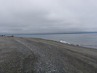
Once we got about a 1/2 mile from the campground there were very few people out on the spit (other than a couple beach combers, one of which was carrying a dead bird....ew.)   Once we got to the point there was seal swimming very close, but we didn't get a shot.  here are the views looking back from the point:


It was a great end to our trip, followed by a delicious fish and chips lunch in Ocean Shores at Bennet's Fish Shack (highly recommend!) 

Wednesday, July 25, 2012

Quinault River - Pony Bridge


On Day 2 of our vacation we tackled the Quinault River-Pony Bridge Trail just past Lake Quinault.  You have to drive about 15 miles on a dirt road to get to the trailhead, so it takes a bit longer to get there than you might plan.  Once again, this trail took us into the Olympic National Park and we were surrounded by big trees!  This trailhead is a starting off point for lots of trails: Graves Creek, the Enchanted Valley Trail, even to cross the entire park and end up on the west side in Dosewallips (someday!)   Needless to say the trailhead was really crowded; easily 30 cars.


The trail has a couple bridges over the river right away and starts out as a converted forest road for the first couple miles.  It was really well maintained, though quite rocky in places.   Once again we were thankful that we've trained on Green Mountain in Kitsap County, because the steep, rocky trails have prepared us for these kinds of adventures.  Along the way we saw huge trees, a few horses on the trail and a really cool little pool that we decided was the fountain of youth :-)


As we came around the bend near Pony Bridge and saw the beautiful teal river below,  we understood why this trail is so popular.


The guidebook talks about being able to retreat back from the trail to find access down to the river, but we couldn't find a good spot.   We ventured past the bridge along the river to find  several small trails that look like campers have created.  We ate our snack here and enjoyed the solitude of the river.   

 As we were hiking back we heard a familiar call in the forest, it was the same sound the owls made that we saw on the Wildcat Lake trail.   We slowed down and kept following the sound until we finally saw it up in the tree!!   We watched him for quite a while and then waited for some hikers we saw coming up the trail so we could point him out.   They were really excited to see it too and started snapping photos. Of course, a little owl in a dark forest is hard to capture with a small hiking camera...

The hike was great and so was the drive home.  We took the North Shore route back along Lake Quinault, and it was beautiful.


Along the drive we were stopped by a passing car of tourists from Germany who were worried they were lost.  Apparently, if you're German, Chris has an accent that makes him sound likes he's from Texas.      (That really bugged him!)    It was another incredible day in ONP, amazing views, beautiful sunny weather and the best companion I could ever have.

Tuesday, July 24, 2012

South Fork Hoh - Big Flat

For our vacation we decided to stay at Ocean Shores and use that as a launching point for day hikes into the Hoh Rainforest and surrounding areas in the Olympic National Park.  Finding a place around Lake Quinault would have meant a lot less driving, but waking up to the ocean every morning was awesome.  We had great weather all week - sunny days are rare in the rainforest so we felt very fortunate!  

Our first adventure was the South Fork Hoh-Big Flat trail.    Unfortunately,  we didn't follow the guidebook exactly for mileage waypoints and ended up at the wrong spot.  We weren't the only ones, two other carloads of hikers were there too and they told us the bridge was washed out and the trail inaccessible.   We decided we'd come too far to let a little washout keep us from the trail, so we put on our bad-ass faces and ventured out. 

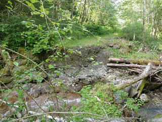
We crossed the creek and headed onto an abandoned forest road we thought was the way to the trail.  it started out fairly accessible, but as we got deeper in the woods it got more overgrown.  After another creek crossing it became inaccessible - and really, really, really buggy.    We turned back and tried another road we had seen off to the right thinking it might lead us to the trail,  but all we found was an abandoned lean-to probably used by a hunter years ago.   We gave up and returned to the parking lot, disappointed that the trail had been left to the elements and no longer existed.  We decided to check out the nearby campground and had the realization that the turn to the campground had the real entrance sign that the guidebook talked about, and that we probably were in the wrong place.  So we followed the road past the campground and it started to match the guidebook exactly.  Here's our lesson for the day:  Match the mileage to the guidebook!!  The combination of other hikers telling us the trail was washed out along with the guidebook saying there was no trailhead sign made us think we were int he right place. Had we followed the mileage waypoints better we would have found the right place much sooner!


The real trail was clearly marked and it was beautiful;  clover lined and full of really, really big trees!


We had to cross a couple creeks along the way but they weren't too difficult to navigate. Because of late start due to our misadventure, we had to make Big Flat our destination rather than the South Fork Hoh so we would be sure to make it back to the car by dark.   We were really sad we didn't have time to go the whole way,  but so glad we found the real trail and got to enjoy the area.


Even with our mis-start and all the bugs,  we had a really great day.  Finally getting in to the Olympic National Park and seeing real old-growth forest was so worth it.  This trail was a little bit overgrown in places, but that didn't pose a problem. We didn't see another soul on the trail even though there were two cars at the parking lot.  Considering our late start we assumed they must have gone up camping somewhere.   Someday maybe we'll make it back to go all the way to the South Fork destination, but that's so hard for us to do with so many trails yet unexplored.  We did learn a couple of valuable lessons about following directions and having better maps!


Saturday, July 21, 2012

Big Creek Trail

Today we ventured into the Southeast portion of the Olympics and hit Big Creek trail.  From Bremerton it took us about 1.5 hours to get there and the trail head is located near Lake Cushman in the Big Creek campground.

We didn't hit the trail head until about 2:30, which once again meant we missed most of the hiking traffic.  Even for a Saturday with great weather, we only saw two other groups briefly.   The trail was well-maintained with a fairly steep incline going up about 900 feet,  and a slower decline which is easier on the knees.

Just from the name of the trail you can tell this hike is all about the water.  We passed near and over the creeks several times before making the small side trip to the confluence where two large creeks meet and become one.  It was beautiful spot, with giant boulders to sit on and enjoy a snack.


Trail volunteers have done an amazing job here, with beautiful bridges and rock borders protecting run off areas.  These guys are our heroes.

The trail length is listed at 4.5 miles,  and the side route to the confluence adds about another mile.  There are some good views of Mt. Washington and Mt. Ellinor along the trail,  but there are also views of clear-cut areas. We did see a few old-growth trees that loggers missed as the south Olympics have an especially brutal history of over-logging, but it  just serves as another reminder to protect this area. We saw lots of great wildflowers, some of which we had never seen before and need to identify.  The only wildlife other than birds that we saw was a glimpse of a furry gray ball running away from us that we could not identify.  We did overhear some hikers talking about a bear sighting, which reminded us we need to get some bear spray!   The most surprising thing was this happy little troll outpost guarding one of the bridges - Rooster saw it first and waited to see my reaction.  

It was a great day:  beautiful weather, great views,  a well-maintained trail and not many other people. 


Friday, July 13, 2012

Wildcat Lake to Gold Creek Through Hike

Today we did our first shuttle hike, parking one car at the trail head at Gold Creek on Green Mountain and then driving around to start our hike at the Wildcat trail head.    We followed Wildcat trail to the Green Mountain Horse Camp and then turned on the Beaver Pond trail to the gold Creek trail junction.   We did not GPS track this route, but our best estimates are about 6 - 7 miles.   Today was a crazy weather day,  with lightning and thunder in the morning that deterred most people from heading out.   We only crossed one other hiker on the trail all day.

The Beaver Pond is not much to see, but the area surrounding that part of the trail is the best.  There are less visible signs of logging and more wildlife.   It was in this area that we saw 2 owls!  We surprised one on the trail that flew up into the trees where we watched each other for a while.  When we decided we had disturbed it long enough we hiked another 20 feet or so and surprised another one, probably its mate.   This made our day!!


Not long after we hit the edge of the forest that has been clear cut fairly recently.   We ventured up into the area off the main trail to see if there were views, and sure enough - there were.


We sat on a couple stumps and ate our snack,  the sun came out and gave us a nice view of the Sound and the mountains.  Later on the trail we got a nice view of the Seattle skyline:


We saw some great wildflowers and a friendly frog on the way too:

It was a good hiking day despite the thunder booms! Our first shuttle hike was a great success. 

Wednesday, July 4, 2012

Mt. Townsend


We celebrated 4th of July by hiking to the highest summit we've done so far, Mt. Townsend.  At an elevation of 6280 feet and round trip mileage of about 9 miles, it was an ass-kicker.  This trail is very popular, so there were a lot of people on the trail even though the weather was not so great.  As we passed people on the way up we asked how it was at the top and everyone told us there were no views today or only a patch of sunshine.  We told ourselves we didn't need views anyway - pshhh, we've seen a million mountain views.  This hike is steady but steep, climbing 2900 feet from trailhead to summit.  

Along the way we encountered quite a bit of snow, even in July!


We also encountered beautiful waterfalls and tons of wildflowers in the alpine meadows. 


All the way up the skies were grey, but as we reached the top the clouds seemed to drop and swirl and give us amazing views!  We decided it was karma (and getting a  late start!)


Hard to tell if it was the thin air or the sheer beauty that made it hard for us to catch our breath, but we both got a little choked up at our achievement and the amazing surroundings.  At 5 months and 2 days past Chris' back surgery, here he is looking eye-to-eye with the Olympic Mountain range.


 Since this trail is so popular, it is very well maintained.  Even with all the people we encountered we didn't see one piece of trash on the ground.  Its easy to see that the folks that hike this trail are more serious hikers who seek to preserve the beauty around them.   Other than a few birds, the only wildlife we saw was a little rabbit - he decided to hide in the trees and not be photogenic. As we descended back down the trail, the fog rolled in and covered all the views but that probably helped us stay on track to get down the mountain before dark. We cut it pretty close, hitting the parking lot at about 8:45PM. 

Today's lesson:  when climbing to such high elevations Chris needs to take decongestants ahead of time.   Once we started the drive home the built up pressure behind his sinuses was so great he said it felt like a knife stabbed him between the eyes when he yawned.  Luckily, it passed after about 15 minutes.  We even got amazing views on the way home.  The moon over Hood Canal was huge and red, and because it was the 4th of July there were fireworks being set off as far as we could see on both sides of the bridge.    It was such a rewarding day that reaffirmed how grateful we are to live in such an amazingly beautiful area.